|
Reported Crop Circles for the State
of New York -
Canisteo, Steuben County (August 12, 2005)
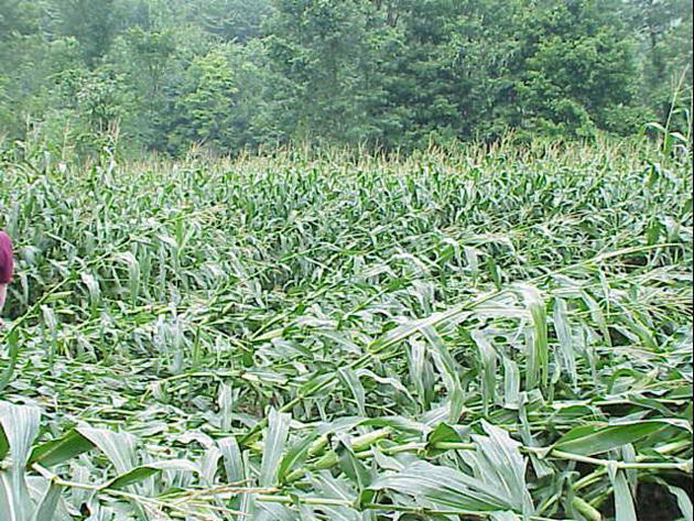
National Weather Service calls ICCRA to report a couple of crop circles in corn they found while investigating damage from a tornado touchdown due south of the town of Canisteo along Hwy. 248.
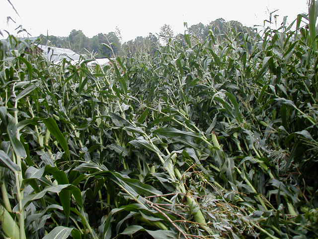
The two crop circles appeared to be RDF-type formations, rather than the swirled, geometric variety. James Brewster, Senior Meteorologist with NWS, did an on-site investigation of the tornado damage, and spotted the two areas adjacent to the tornado track damage. Although he had been specially trained by the NWS in evaluating severe weather damage on various crops, he said hed never seen anything like this damage in his entire career.
ICCRA suggests the NWS look at recent data collected by the National Lightning Detection Network Array for anything unusual in the area during the time of the tornados passing.
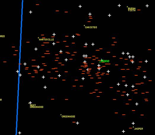
Brewster, Senior Meteorologist with NWS, finds a high number of rare, strong, positively-charged lightning ground strokes in this specific area during the time the reported tornado touched down at this location.
The weather front associated with this event is part of the same line of severe weather that was involved with the Yellow Springs, Ohio event on the same day.
Crop type: corn
Source: Jeffrey Wilson
|
|
City
/ County / Date:
- [unknown]
(1927?)
- Conklin,
Broome County, NY
(June 16, 1964)
- Ithaca,
Thomkins County, NY (October 20, 1967)
- Gallupville, Schoharie County (August 5, 1968)
- [unknown] (1972)
- Freeport, Long Island (Big Crow Island), Nassau County (November
7, 1973)
- Annadale, Staten Island, Richmond County
(February 14, 1975)
- Farmingdale, Nassau County (September 30, 1989)
- Medina / Shelby, Orleans County (July 5, 1991)
- [unknown], (July 17, 1991)
- [unknown], Herkimer County
(July 26, 1992)
- Vickerman Hill, Columbia Center / Herkimer / Mohawk Valley,
Herkimer County (July 21, 1993)
- Vienna / Oneida Lake, Oneida County (August 14, 1994)
- Schodack, Rensselaer County (August 23, 1994)
- Marion, Wayne County
(August 11, 1997)
- Marion, Wayne County
(October 21, 1999)
- Weedsport, Cayuga County
(July 19, 2001)
- Fremont, Sullivan County (September 2001)
- [unknown], Steuben County (September 2001)
- Amherst, Erie County
(July 31, 2002)
- [unknown], Steuben County (August 9, 2002)
- Saratoga Springs, Saratoga County (June 12, 2003)
- Canisteo, Steuben County
(August 12, 2005)
- Mendon, Monroe County
(October 14, 2005)
|